Trekking on the costa Rei - hiking route to Monte Ferru
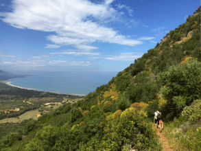
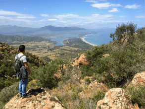
This tour on the mighty mountain of Monte Ferru is one of the outdoor highlights of Costa Rei. As you climb the volcano, which has not been working for centuries, you will discover varying fauna and a breathtaking panorama of the coast from Villasimius to Porto Corallo.
Go wild in Porto Pirastu
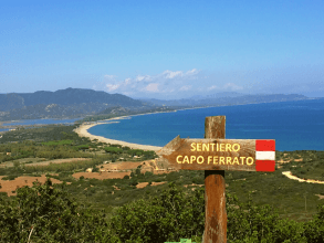
The starting point with the best parking options is the pine forest of Porto Pirastu. The best way to approach this place is from the south. Coming from Feraxi / San Priamo is not recommended as this country road is not asphalted. Back on the main road, on the other side of the road there is a sign points to the hiking trail "Sentiero Escursionistico Monte Ferru 402". A straight line leads past several estates and on the right the mountain cone of Monte Ferru rises majestically from the arid landscape with a highly weathered volcanic rock. At a crossroads to the right you can go straight up via an unpaved road to a gate, which also indicates the nature reserve " Oasi Naturalistica di Capo Ferrato ". Via a ladder you can go over the gate.
High on the Eisenberg!
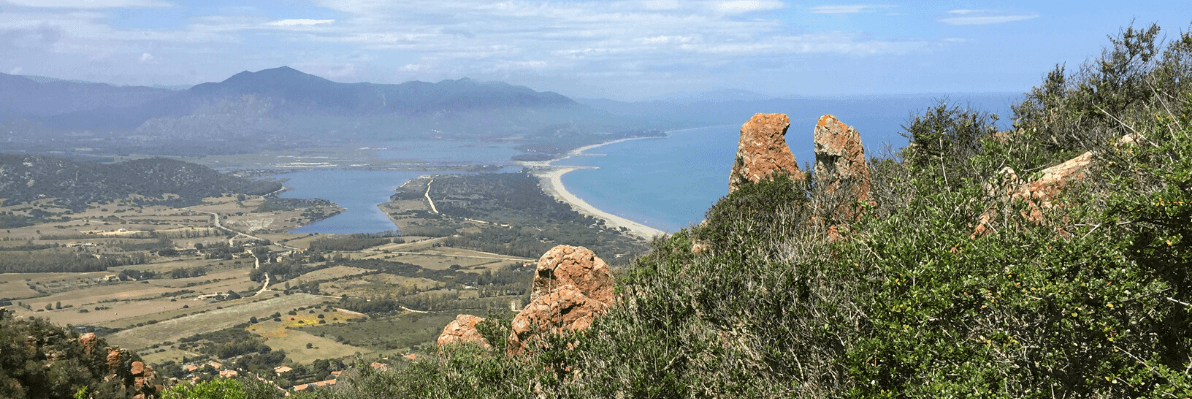
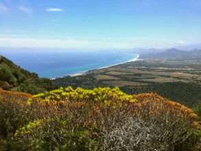
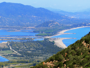
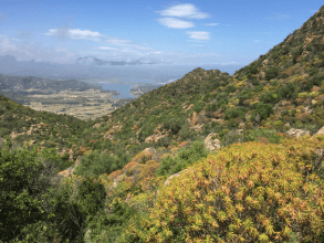
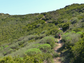
From now on, sporadic red and white markings with number 402 point the way up. First you walk over heavily weathered lava rock slabs and over rough volcanic rocks surrounded by countless fig cacti. Further up the climb, the more Euphorbia trees adorn the mountainside. The shrubs with their bulbous crown shine bright green in the spring and in the fall because they bloom twice a year. In the summer, however, the shrubs are largely withered and maroon. The path leads uphill on the east side of Monte Ferru, whose name means something like Eisenberg. As soon as the first ridge has been crossed, the panorama opens to the north: the endless long beach of Feraxi. The beach is interrupted by the influx of the lagoon lake of the same name, Stagno di Feraxi, and flows into the alluvial plain. In the distance you can see the watchtower of Torre Salinas, behind it stretches the actual endless beach of San Giovanni and Muravera to Porto Corallo.
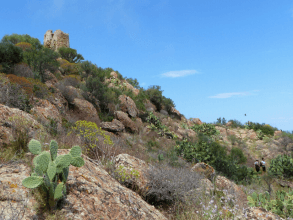
Once at the top: the tower of Monte Ferru
The path gradually ascends in eastern direction. With the crown of the old watchtower above us; tlocated at an altitude of 300 meters, dates from the time of the Spanish occupation on the island and was intended to warn against pirate attacks. From this point you have a panoramic view of the road south-east coast of Sardinia. In the south you'll see the kilometer-long dream beach of Costa Rei, with the old volcanic cone from Monte Ternu and Isola Serpentera far out to sea. In the east stretches the jagged cape of Capo Ferrato, we will tell you more about this in the second part of the walk.
After hiking along the eastern flank of Mount Ferru, the path leads us, initially very gently downhill over quite steep and slippery places to the boundary of the nature reserve. A large anti-fire path, a strip built in the forest due to fire hazards, curves to the right and after a few hundred meters you end at a large gate with a ladder to the country road.
After hiking along the eastern flank of Mount Ferru, the path leads us, initially very gently downhill over quite steep and slippery places to the boundary of the nature reserve. A large anti-fire path, a strip built in the forest due to fire hazards, curves to the right and after a few hundred meters you end at a large gate with a ladder to the country road.
Back quickly or a bit further?
If you want to end the almost three-hour hike, on the right you can walk back to the starting point in about 20 minutes on the hardly traveled country road.
... a detour to Capo Ferrato
If you still have energy for another hour and a half hike, keep to the left on the main road and after a few meters cross another fence on the opposite side of the road. From here it goes on unmarked, but hardly to be missed paths to the Capo Ferrato.
At first it goes slightly uphill to the right through dense mastic bushes. The unmarked trail continues over two mountain peaks, first downhill again, then uphill again. A little sense of direction is required here - straight to a small tower that marks the highest point of Capo Ferrato. A few stone stairs lead uphill, past old military installations to the old anti-aircraft tower.
Once at the viewpoint, the trail continues downhill without markings. As an orientation you can follow the water flow that flows through the forest during the winter months. At the end of the Capo Ferrato, which slopes gently from here, you can recognize the old watchtower at the end of the rock, located 50 meters above the sea. The route continues flat and ends on a dirt road.
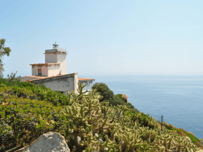
A path leads straight ahead in 20 minutes to the lighthouse (Faro), to the left a path along the coast to the bays of S'Illixi and Cala Sa Figu. The way back towards Porto Pirastu leads to the right on the bumpy road to the sea, where shady picnic benches and a pebble bay await in a pine grove.

Plan your walking holiday in Sardinia with Sardinia4all!
What is an appropriate stay, the best beach or region for outdoor enthusiasts? Ask us about the best options for your walking holiday Sardinia!
Timo
Sardinia4all
Timo
Sardinia4all


Wij maken jouw vakantie op Sardinië graag op maat!


